Here in early December, we’ve explored all of the beaches in and around Sayulita within a short hiking distance. Or so we think.
Playa Central, Sayulita’s main beach is easy enough to find (but my least favorite due to the crowds).
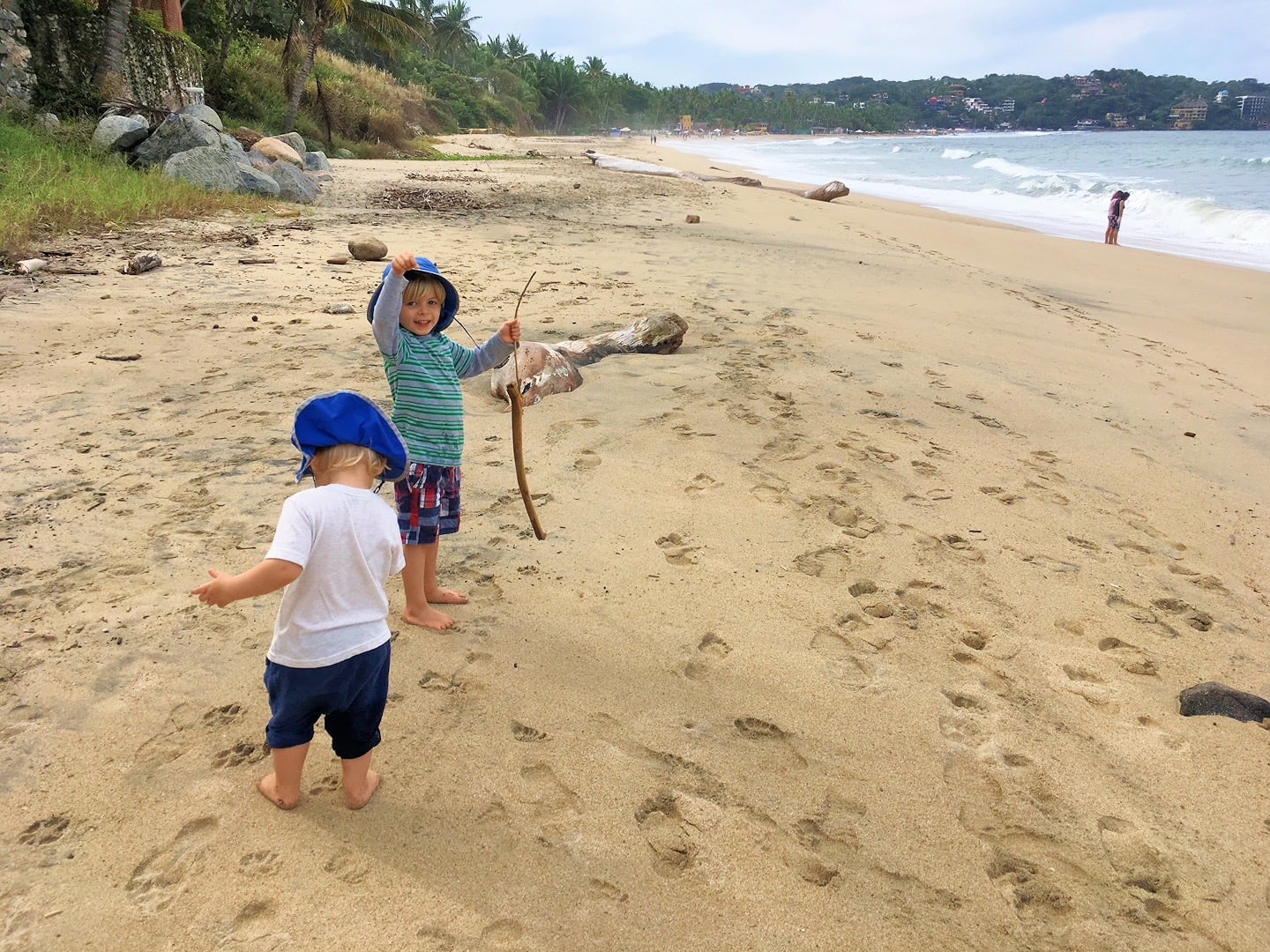
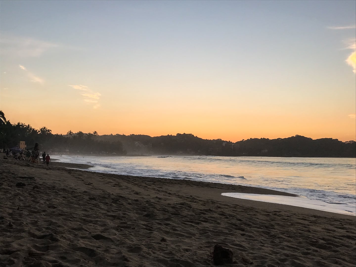
North Beach is our go-to beach for sunsets and sandcastles, as it’s the closest to where we live and more spread out. We can choose any number of access points on any given day to lose the crowds or at least find a nice spot for ourselves without too much encroachment.
The golf cart has given us more options along North Beach, so when things get a bit more crowded on the weekend, we can now head north a bit farther and find a nice area for the boys to run around.
Playa Malpaso was our next discovery. We first accessed Malpaso by way of a moderate hike over headland, but have since been making the journey via the easy inland jungle trail with the boys.
Playa Carricitos is our most recent discovery, which I first reached on foot with Riley on my back, via a five-mile roundtrip walking loop. Since getting the golf cart, we’ve been able to cut out most of the walking distance, leaving a half mile hike down to the beach from the parking lot.
However, a few beaches within practical striking distance of Sayulita remain undiscovered for us: Playa Escondida, Playa Patzcuaro, and Playa Patzcuarito.

It’s not clear to me whether the latter two are the same beach, or if any of them can be reasonably accessed.
There are numerous beaches that lay beyond what I’ve mentioned, but these are the ones that I’ve determined can be reasonably accessed with the boys via a combination of golf cart and hiking.
It’s helpful to note that, while our golf cart has somewhere in the ballpark of a 20 mile range (at least in theory), that our main constraint is where we’re allowed to drive it.
In Mexico, no registration is generally required for electric golf carts. Which is great for people like us, but limits where we can go.
Technically, golf carts aren’t allowed on Carreteras (highways), but there is a grey area here due to the fact that a handful of neighborhoods in town simply can’t be accessed without driving on a Carretera.
Mexico 200, the main highway that connects Sayulita to all major points north and south (e.g. Puerto Vallarta and Tepic), is totally off limits.
There’s no grey area there. And for good reason. It’s a busy, narrow two-lane highway with no shoulder and regularly used by commercial trucks.
However, Punta de Mita highway, a minor byway that connects Sayulita to Punta de Mita, is a bit more grey.
There are also a number of paths that dart in and out of the jungle where the golf cart would be totally free to roam.
But good maps are hard to find for these trails. And it’s still not clear what the functional range of our cart is since the charge gauge doesn’t work all that well.
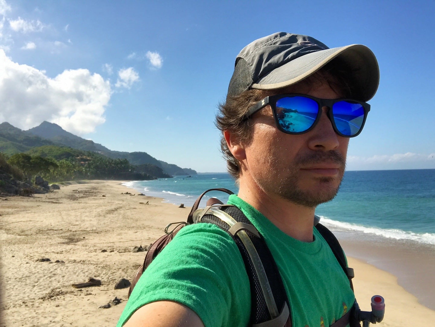
I’ve set aside Wednesday as my hiking day, with or without kids. Today’s Wednesday, and both boys are spoken for. So, today, I’m heading out alone to see what I can find.
I’ll drive the cart to the far southern end of town, then hoof it south from there.
If all goes well, I’m anticipating about a five mile hike today. But I’m attempting to do a loop without a good map, so it may be much longer.
The outbound leg is pretty straightforward and mostly involves walking along the highway. Coming back, I’m going to attempt to skip the highway and follow a series of roads that hug the coastline.
Google Maps indicates that those roads don’t go through to make a full loop. I have another map that says they do, or did at some point.
So, I could find myself at the four-mile point, just a mile away from town having to turn back and trace the last four miles.
Or, I’ll find a path through the jungle.
Or, I won’t even be able to access these beaches in the first place and will have to turn back earlier.
A lot of unknowns, but it’s all part of the adventure.
I got 3L of water in my pack bladder, a hearty snack, and a charging brick for my phone. Time to head out!
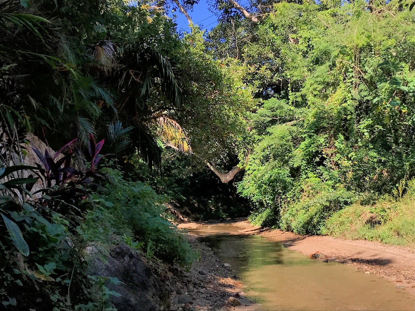
Passing over the Sayulita River, it’s getting clearer by the day we’re definitely in Dry Season.

Walking south on Punta de Mita highway. At this point, the shoulder is uneven and sporadic. But there aren’t a lot of cars either.
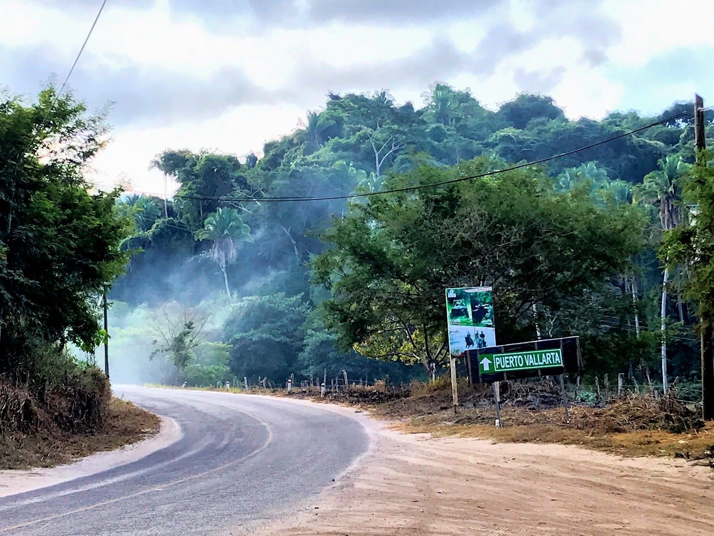
After 45 minutes walking along the highway, I reach KM 5, the turn off I’ve been looking for. I could keep going to Puerto Vallarta, but my GPS apps tells me that would require an additional 11 hours of walking.
Mañana?
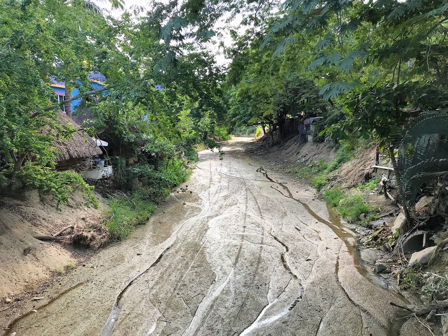
The next 15 minutes take me past grazing cattle and a small village, where the road abruptly turns into a fairly significant stream.
My map app says this is the main road to the next town. Despite my disbelief, I head on. A handful of passing cars and a Coke truck confirm that this is, indeed, the main road between the two communities.
After 15 minutes of walking along the narrow banks of the stream, I suddenly discover I’m on the wrong side, and the stream has widened significantly.
I backtrack a bit to a narrower section, toss a few large rocks in, and make the leap to the other side, narrowly avoiding slipping into the foot-deep water and walking the rest of the way with soaked shoes and socks.
As the stream begins curving to the left, a paved road appears, leading out of the stream. Calle Patzcuaro, the main road. If all goes well, this is the route that will ultimately lead me back to Sayulita.
I immediately spot a sign for Public Beach access and follow it to the top of a hill.
I keep an eye out for more signs leading to the public access, but only see these other signs alerting visitors that the houses in this area are protected by a network of cameras and alarms.
Awesome.
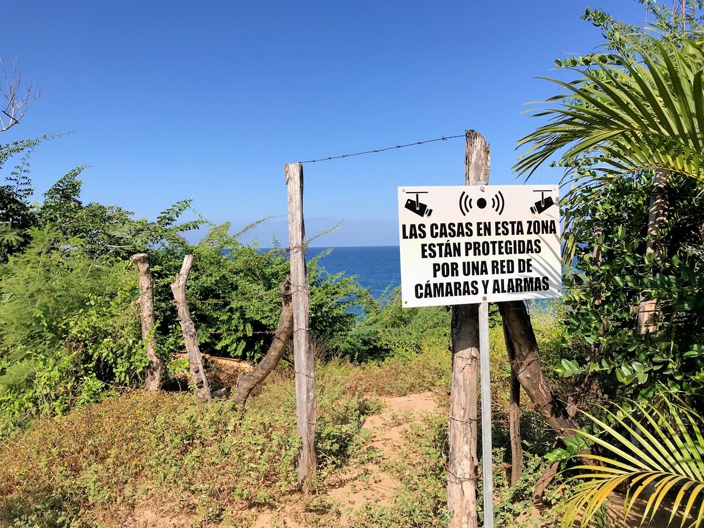
I eventually find a narrow path with a sign alerting visitors not to litter or camp. Even though there is no clear indication that this is the public access, I figure it’s as close to an official sign as I’m going to find.
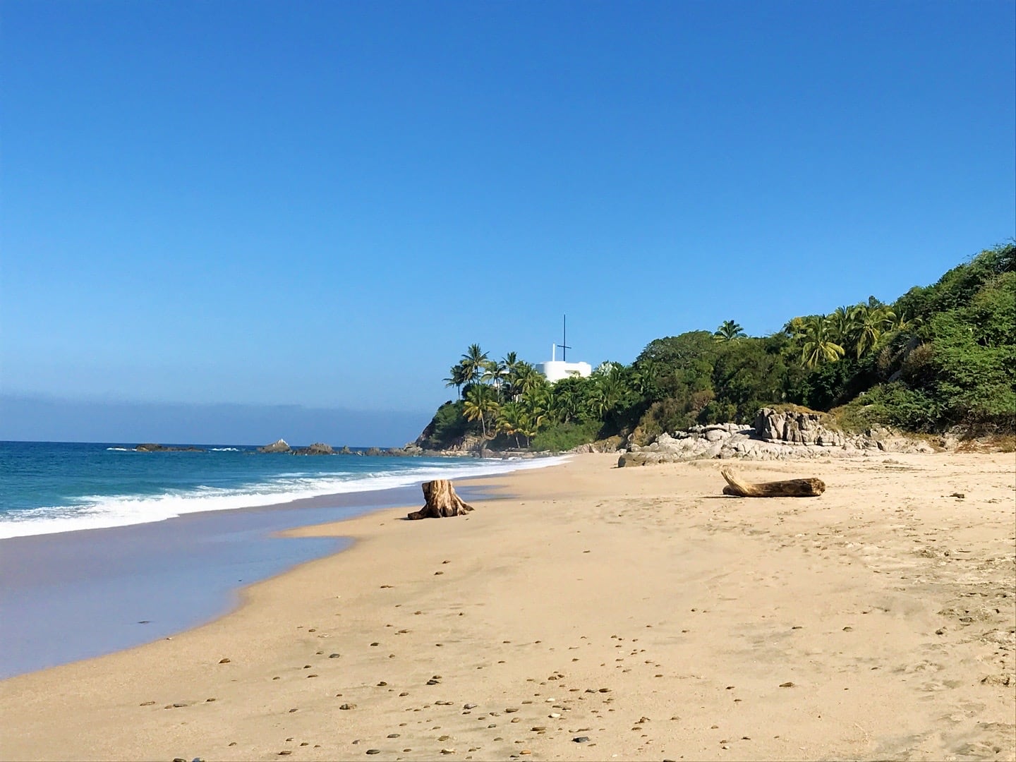
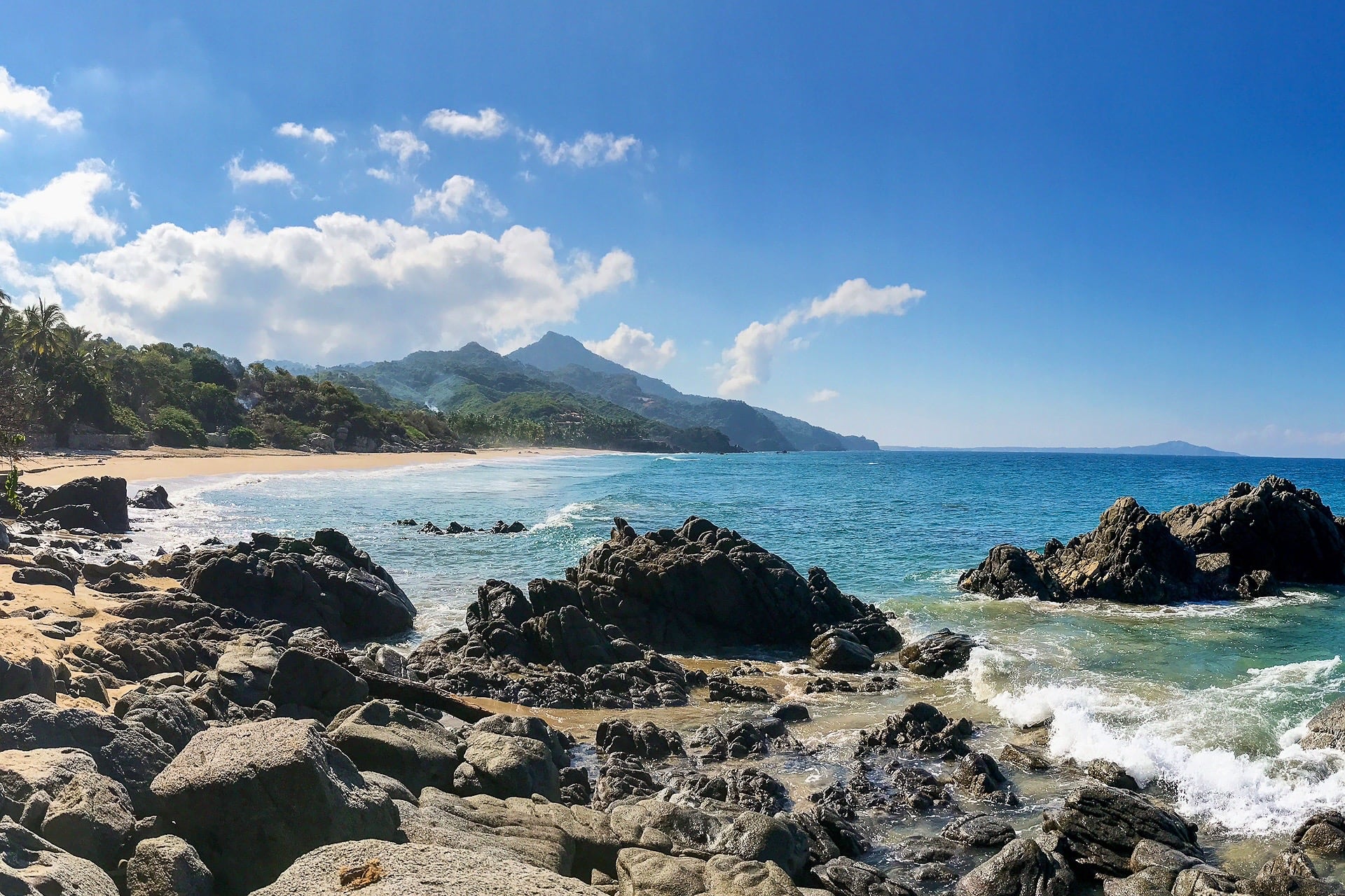
After an eventful morning of hiking, I’ve arrived! Playa Patzcuaro. For our purposes, this is likely the farthest beach south that we can reasonably access, albeit with a bit of effort involved.
It’s a beautiful beach, without a soul in sight. I make my way to a conspicuous rocky outcropping, climb to the top and have my midway snack.
After 15 minutes, I head to the far north end of the beach to see if there’s any possible way to access the next beach from Patzcuaro.
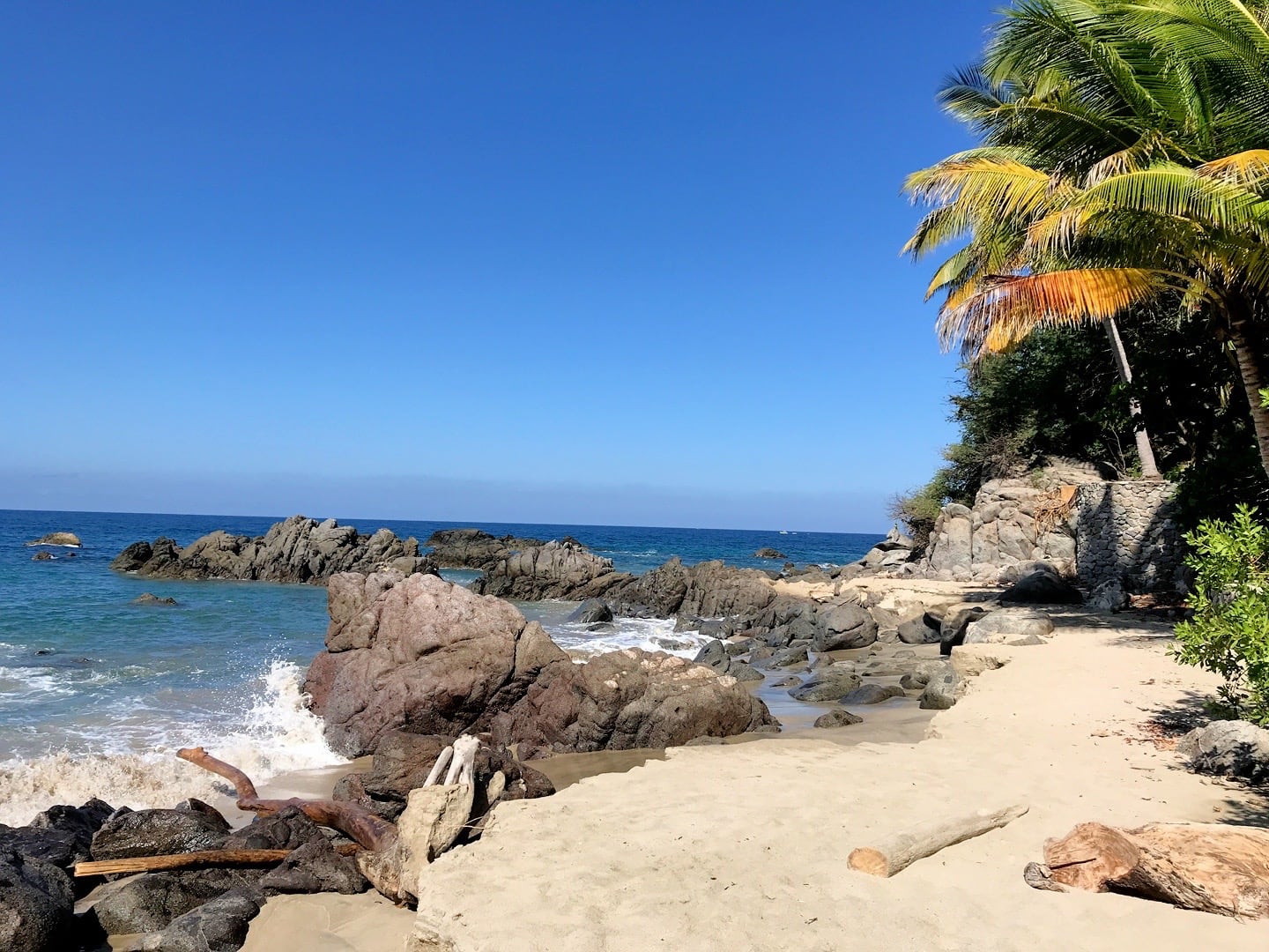
There doesn’t appear to be any way of accessing the next beach north from here. But I’m struck by three things: old stone steps and seemingly lead nowhere, the deep blue of the rocky cove, and the view of Monkey Mountain to the south – undeniably the next hiking conquest on my list.


Looks almost nice enough to snorkel in. But these still photos belie the powerful surf that crashed down fairly frequently.
After a good amount of time resting and exploring Playa Patzcuaro, it’s time to get back on the trail and head north to find the next beach, Playa Patzcuarito (if it actually exists, that is).
I follow Calle Patzcuaro through a well-manicured neighborhood of multimillion dollar properties mostly used for weddings and high end rental properties. The road twists and turns, hugging the coast, then darting up hills into the jungle.
I’m amazed to find that the majority of the road is paved, albeit with cobblestone and cement tracks.

The road eventually leads past a sign for the beach. I follow it down, and low and behold, Playa Patzcuarito. It does exist! More on that one in another post.
In the end, the road connects back to where I parked the golf cart, completing the loop. Playa Patzcuaro is beautiful, but I doubt we’ll return much without a legitimate car. It’s just a bit far of a hike for the kids.
On the other hand, I’m pleased to discover that Playa Patzcuarito is easily accessed by a half mile trail leading from a parking area where we can leave the golf cart. So, we’ll definitely be returning to this one.
In all, 6 miles for the day over about 2.5 hours. Not a bad way to spend a morning.

In other news, I’ve finally gotten my hands on some legit charcoal. I couldn’t find a grill here in town or in Nuevo Vallarta (where the big box stores are located), so I decided to order one online from the Mexico equivalent of Amazon.
I was pleased with my charcoal find. It’s the old school stuff I’m used to using overseas and not the manufactured briquettes. No accelerants, binders, or filler here, just pure, unadulterated charcoal.

To top it off, hand-formed patties from ground beef that was ground in front of my eyes from the day’s fresh delivery. Doesn’t get fresher than that. Barbecue sauce and grilled to medium rare.
Best burgers I’ve had in a long time.
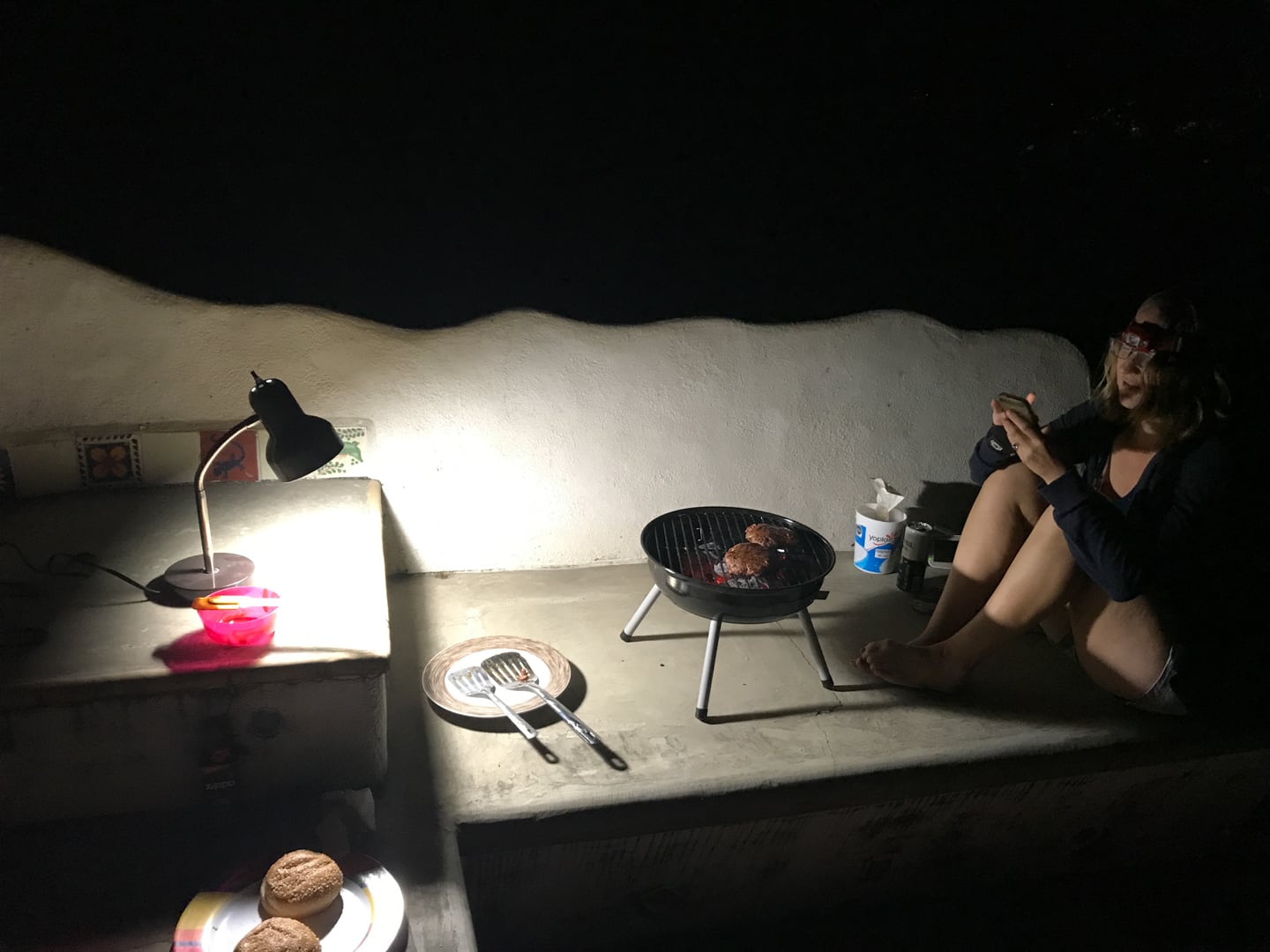
It’s actually starting to get a bit nippy here at night. Lori heard I was grilling and came up to warm herself.
We don’t have any lights on the roof, so we’re making do with an office lamp. But I’ve got some ideas to rectify that.
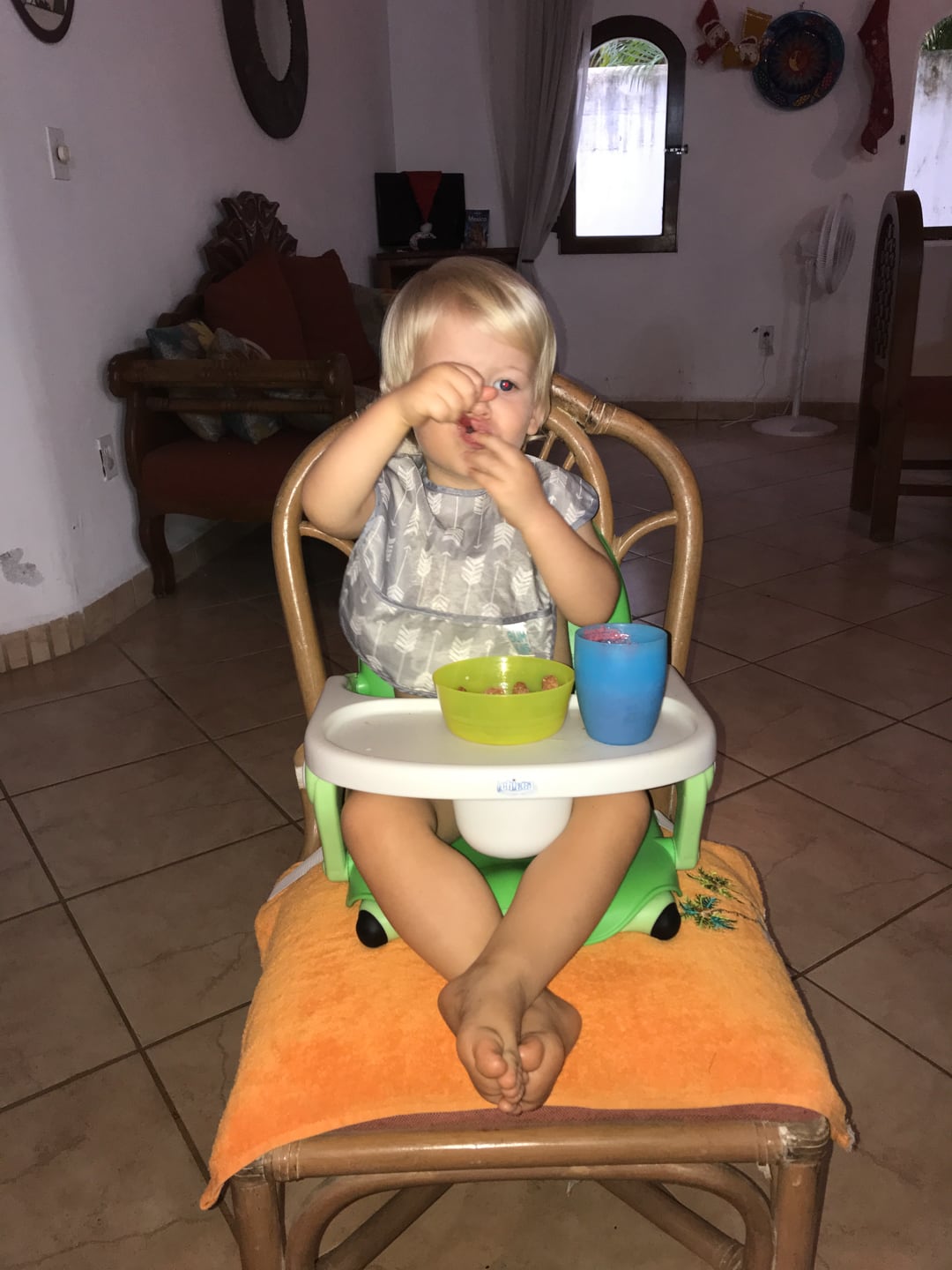
Riley’s high chair setup. We opted for a portable high chair rather than the full size kind we used previously. We’re hoping this makes eating out a bit more enjoyable, as Riley has become a major flight risk, lately.
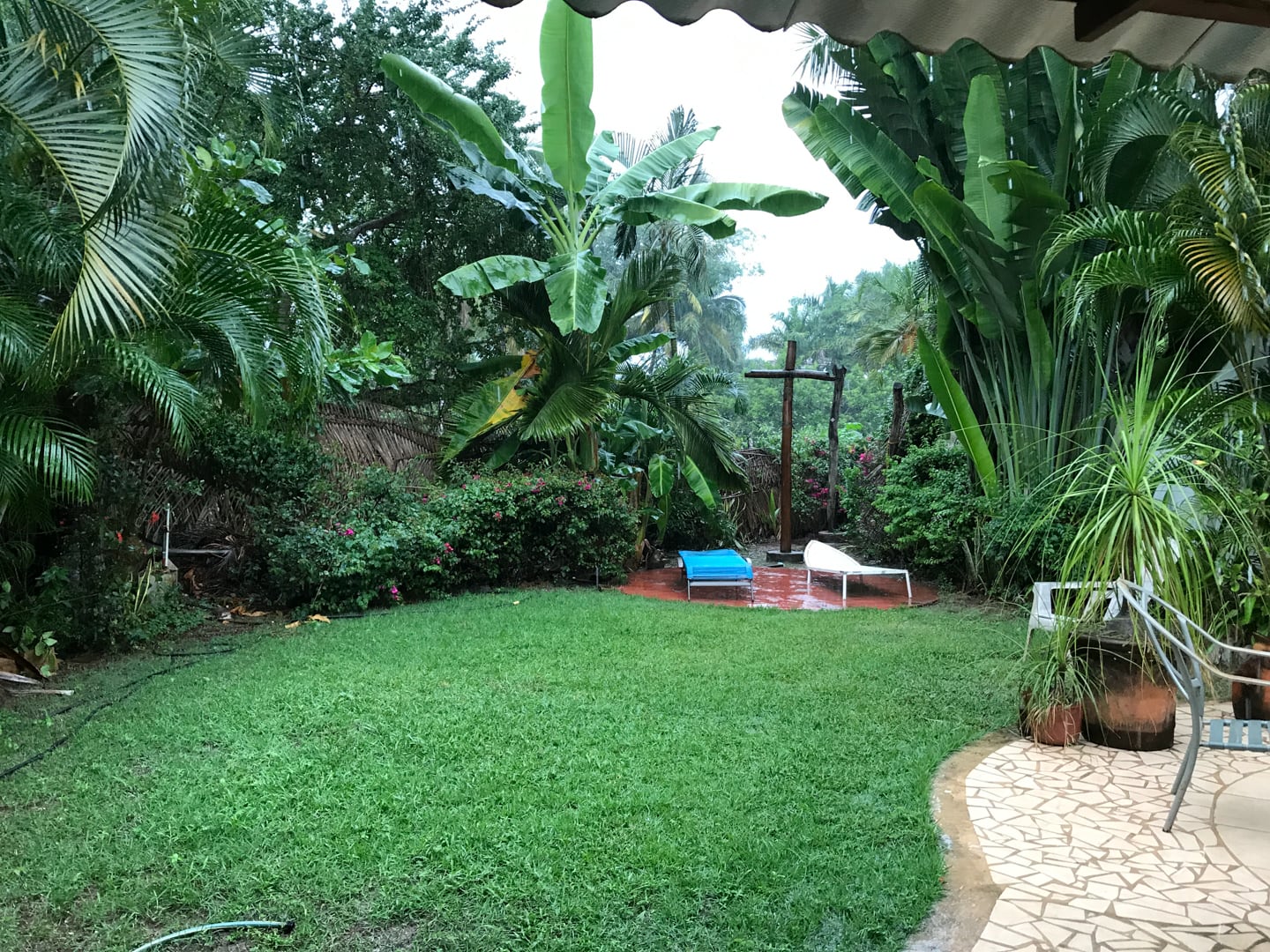
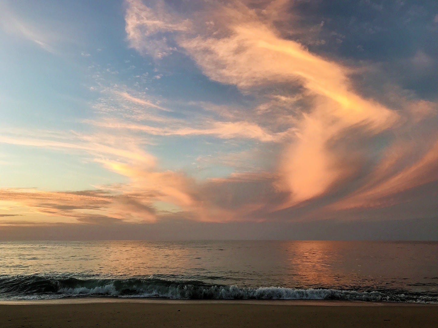
A rain storm surprised us out of nowhere, and the clouds lingered for the next several days.
It hadn’t rained in weeks and just happened to be the night after I had spent nearly an hour giving the grass a good watering, of course.
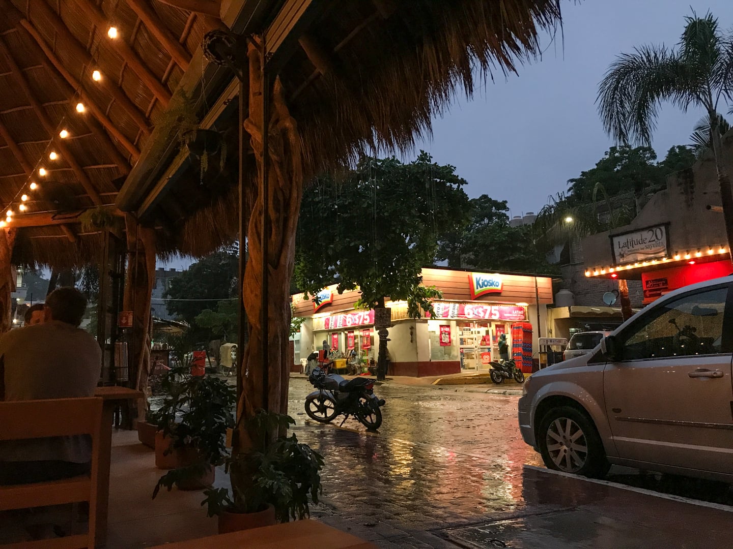
Sayulita takes on a very different vibe in the rain. But that doesn’t stop the barefoot surfers heading down to the water to catch a wave.
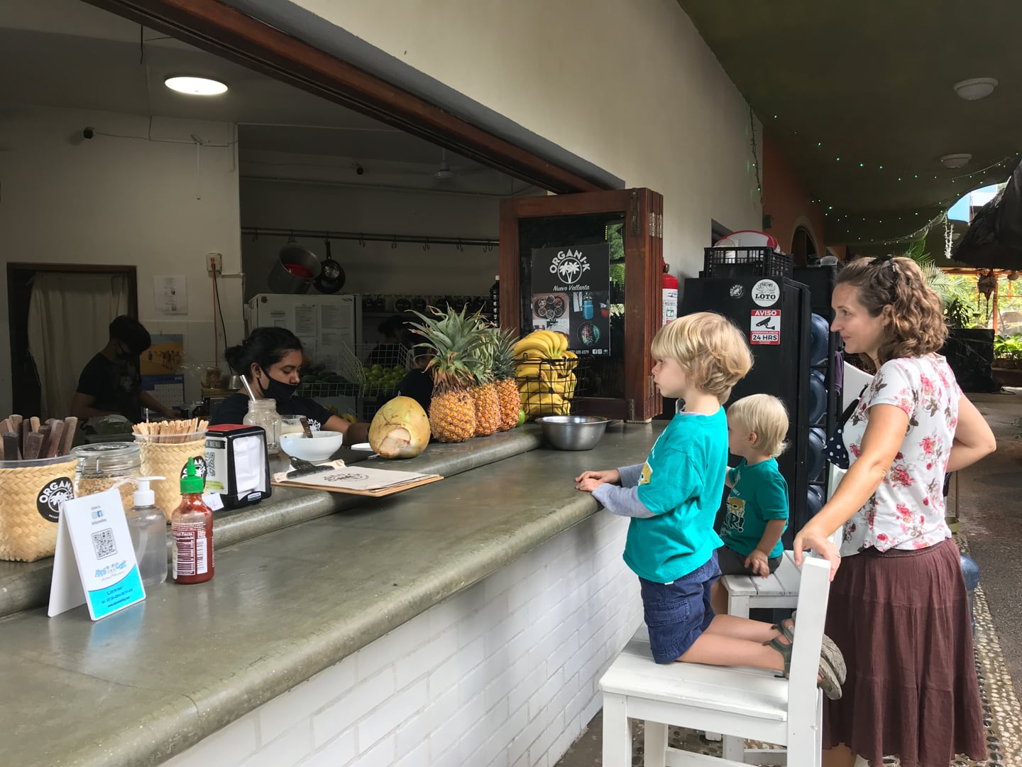
Ordering up a smoothie at Organik, part of Noe’s surprise for reaching his star chart goal.
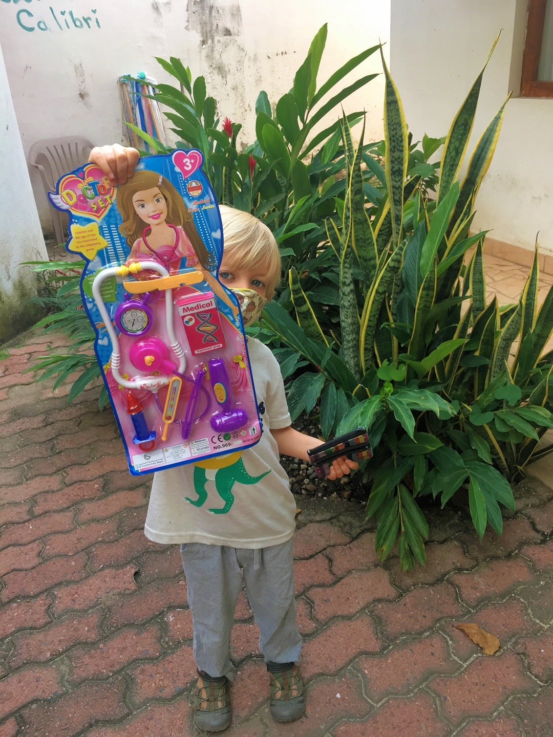
The other part of his surprise. He’s been eyeing this doctor’s kit for a while.
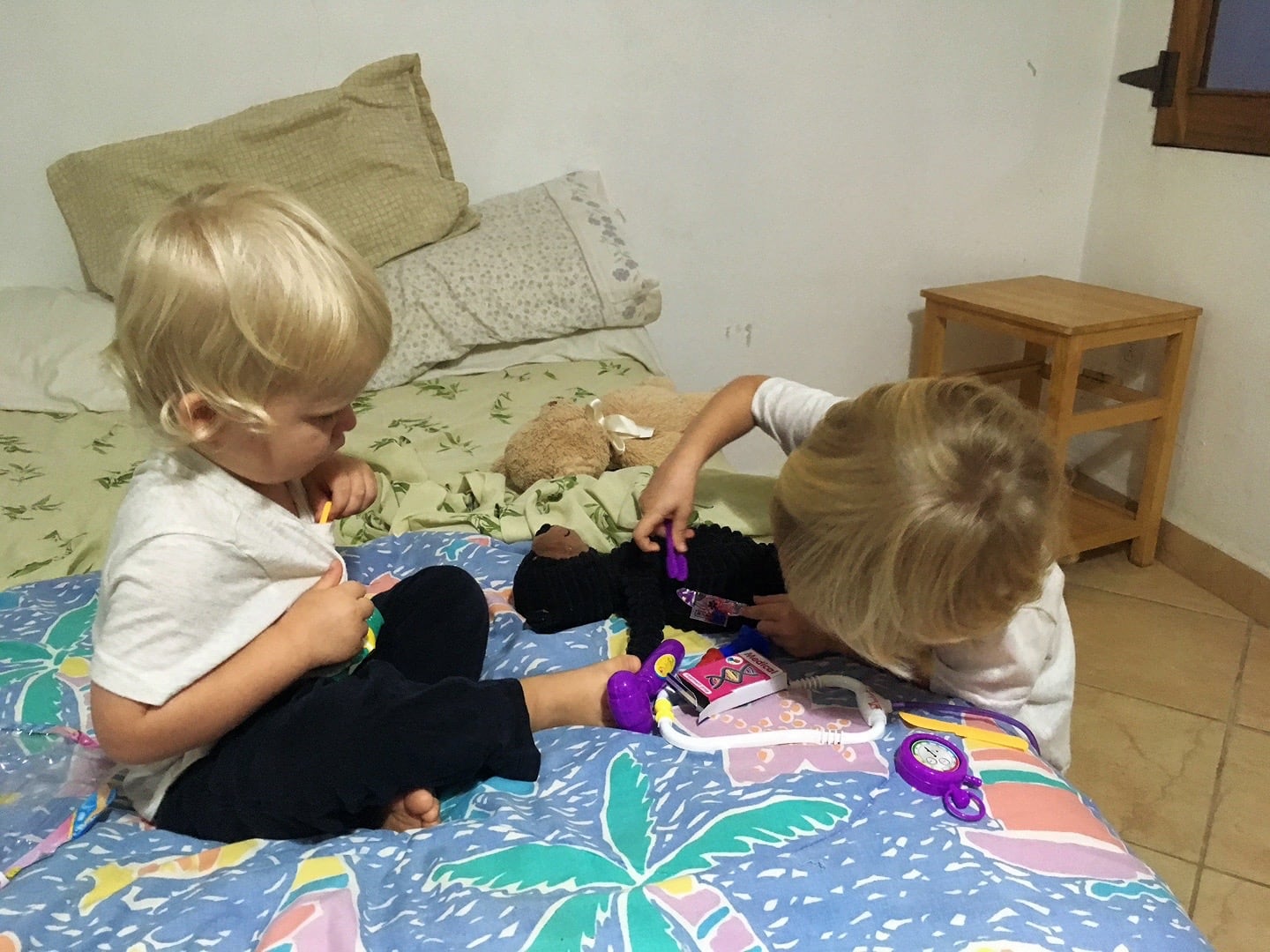
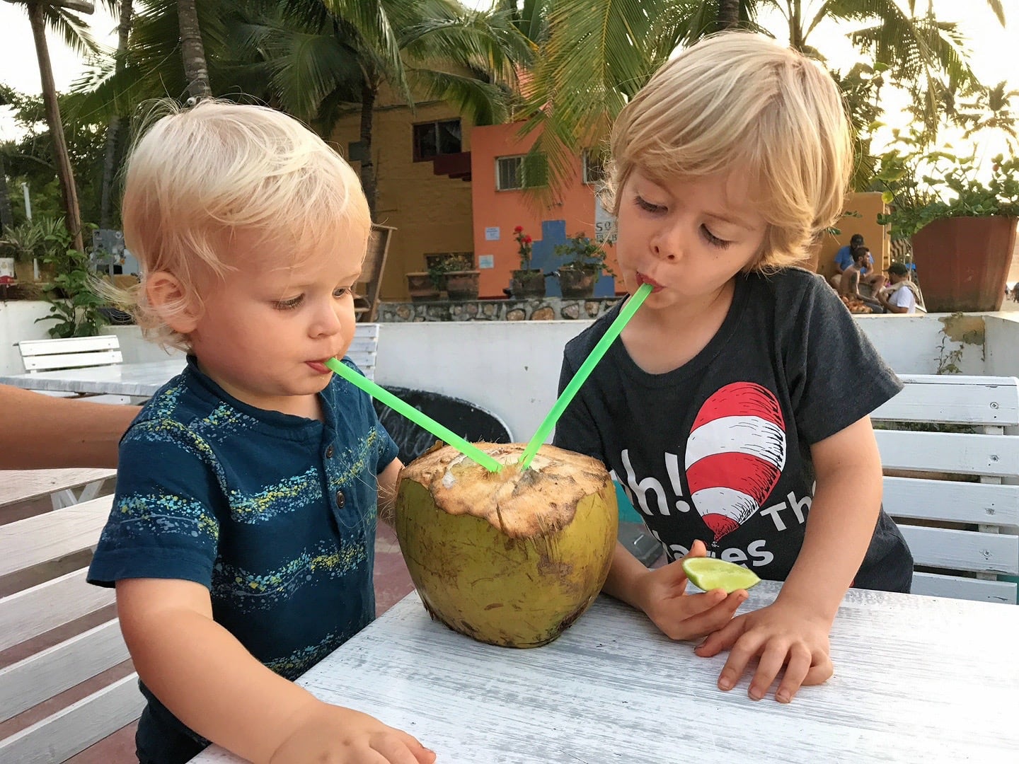
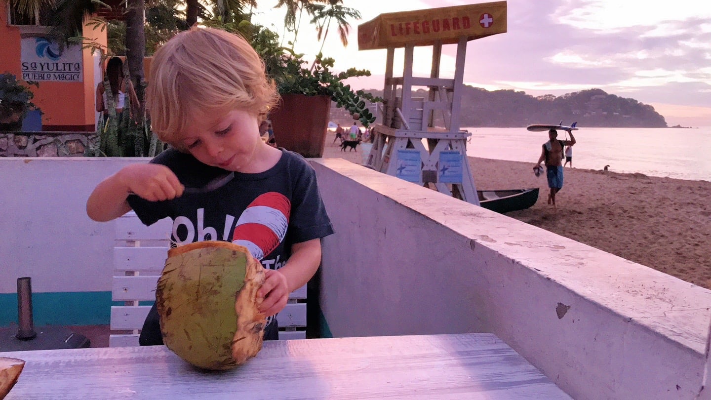
Now, time to give it a go. Riley will be assisting.


I am glad you had a chance to scout out some other beaches. I love watching the boys play doctor together and share their coconut.
Congrats to Noe for reaching his goal!! And love the “high chair” for Riley—wish we had had that for our little escapist!! Great hike—what a beautiful place you live in.